Elevate your land management and project planning to new heights with our advanced volume calculation services and Digital Elevation Models (DEMs). Tailored for accuracy and efficiency, our solutions empower engineers, surveyors, and environmental professionals with the data they need to make informed decisions.
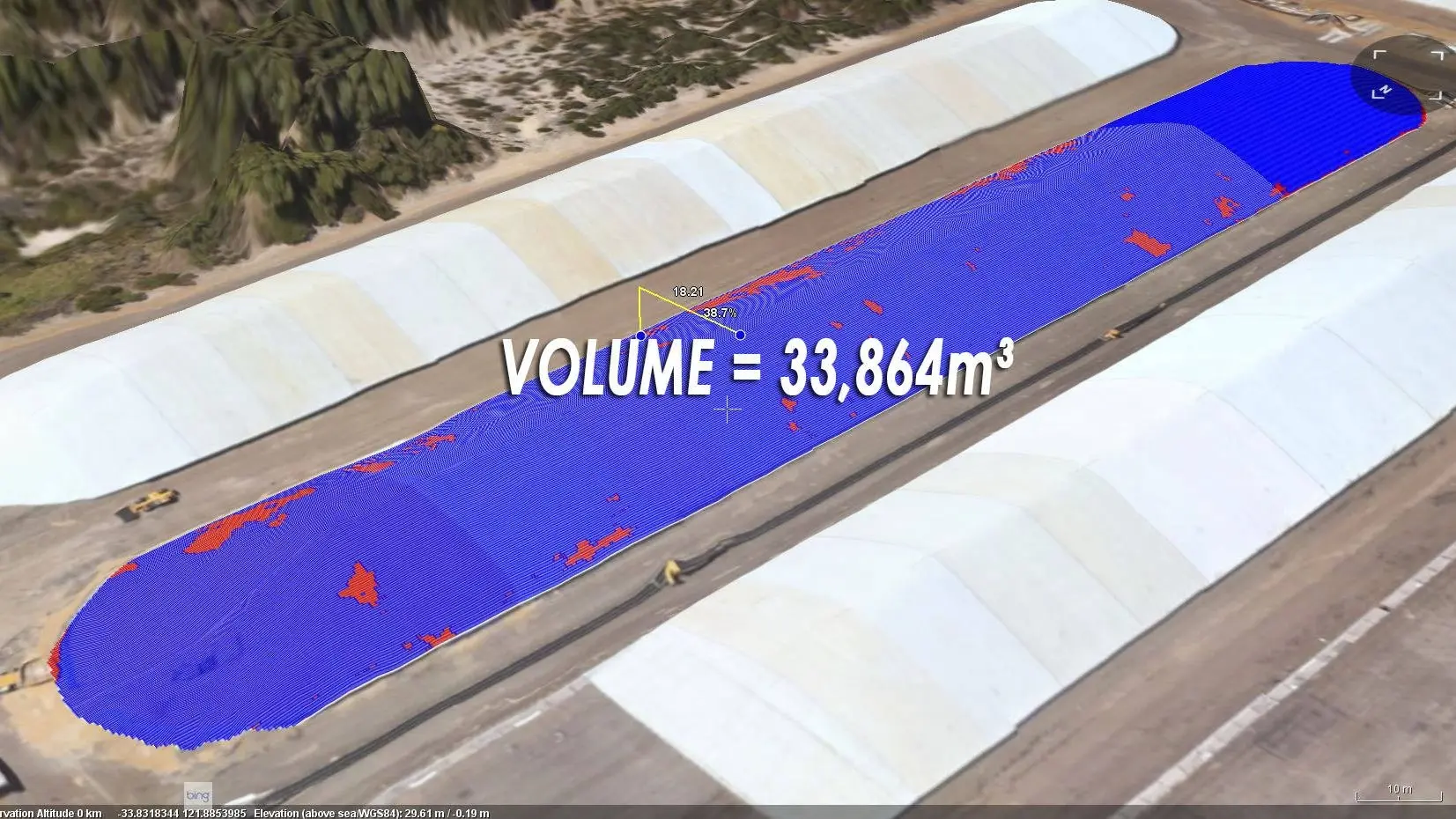
Accurate Volume Calculation: Whether it's for mining, excavation, or landfill management, our volume calculation services provide precise measurements. This accuracy is crucial for budgeting, resource allocation, and operational planning, ensuring that your projects are both cost-effective and environmentally sustainable.
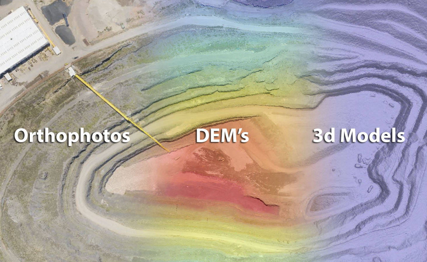
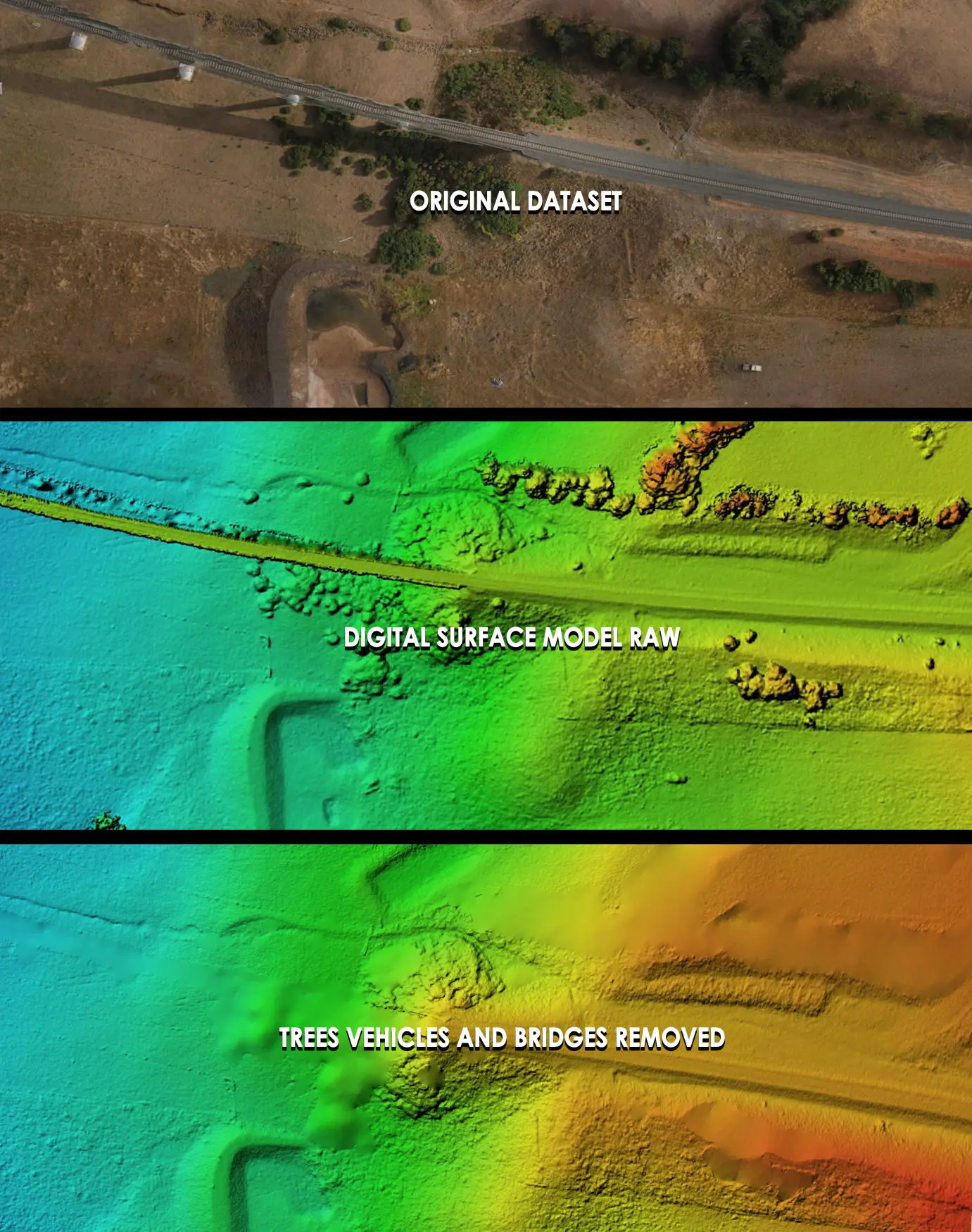
Detailed Digital Elevation Models: Our DEMs offer a comprehensive topographical representation of your terrain. Ideal for flood risk assessment, urban planning, and agricultural management, these models provide essential insights into land elevation and slope, enabling strategic planning and risk management.
With our technology, turn complex landscapes into clear, actionable data. Our volume calculations and DEMs are more than just numbers and contours; they are the building blocks for successful project execution. Partner with us to navigate the intricacies of your terrain with confidence and precision.
At the forefront of land development and construction efficiency, our cut and fill volume calculation services are designed to streamline your projects from the ground up. Our precise data not only simplifies the complex process of earthmoving but also ensures accuracy and cost-effectiveness in every project phase.
Versatile Data Formats: Catering to the diverse needs of our clients, we provide data in a wide array of formats, including LAS, E57, and more, ensuring seamless integration with your existing software and systems.
Compatibility with Web Calculation Platforms: Our services extend beyond traditional data delivery. We embrace the power of web-based calculation platforms, offering you the flexibility to access and analyze data anytime, anywhere, fostering a more dynamic and responsive project management approach.
Whether you're an engineer planning a large-scale infrastructure project, a construction manager overseeing a building site, or a land surveyor mapping out new developments, our cut and fill volume calculation services are your key to precision and efficiency. Reduce waste, optimize resource use, and manage costs effectively with our comprehensive solutions. Trust in our data to guide you through every excavation and fill decision with confidence and clarity.
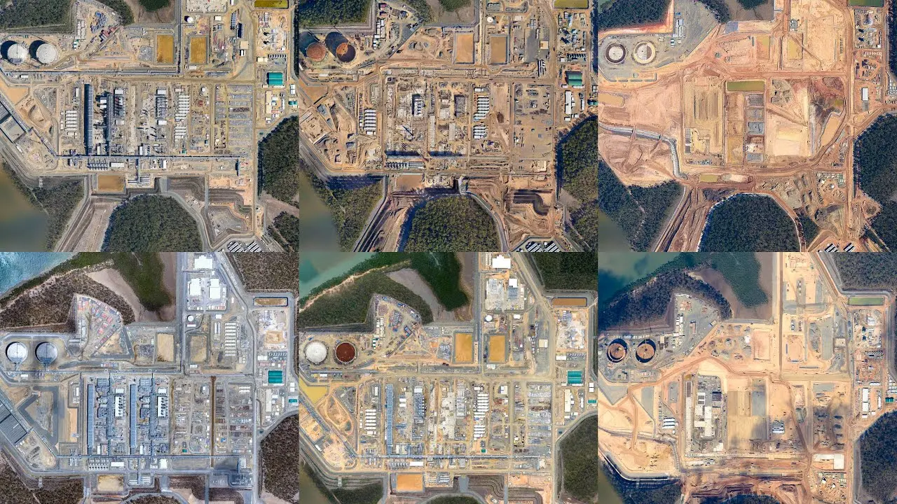
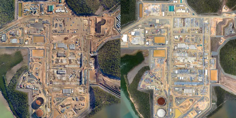
We can take orthorectified photos from the same position monthly to accurately determine site progress and changes over time. Both large scale and small scale projects.
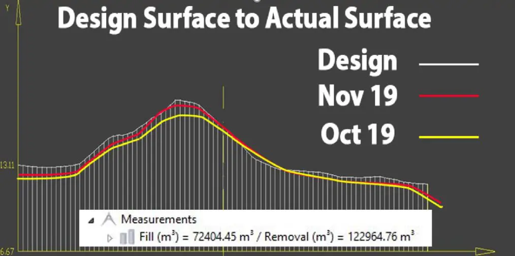
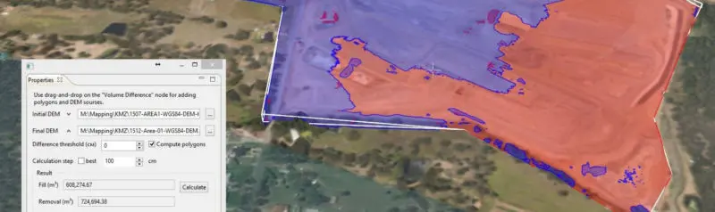
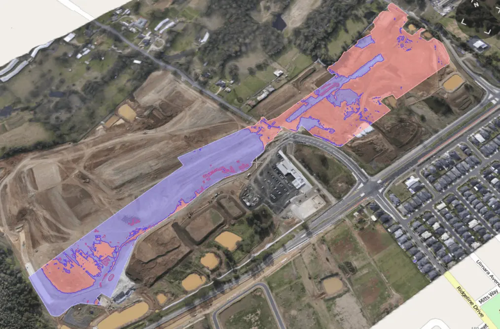
Demonstrate how material compares to the design surface.
Capture cities, regions, towns, mines and construction sites with extremely high quality volumetric 3D models. Use the right mouse button change the orientation of the model above.
We service Australia-wide, based in the beautiful Sunshine Coast, QLD.
PO Box 294
Coolum Beach QLD 4573
Australia
Local 1300 022 637
International +61 488 112 112
We are on standby 24/7 feel free to call any time.

No Code Website Builder