iTide
Animal-track annotation and research tools for our team and collaborators.
iTide team access
Airborne camera systems, georeferencing, photogrammetry and image analysis.
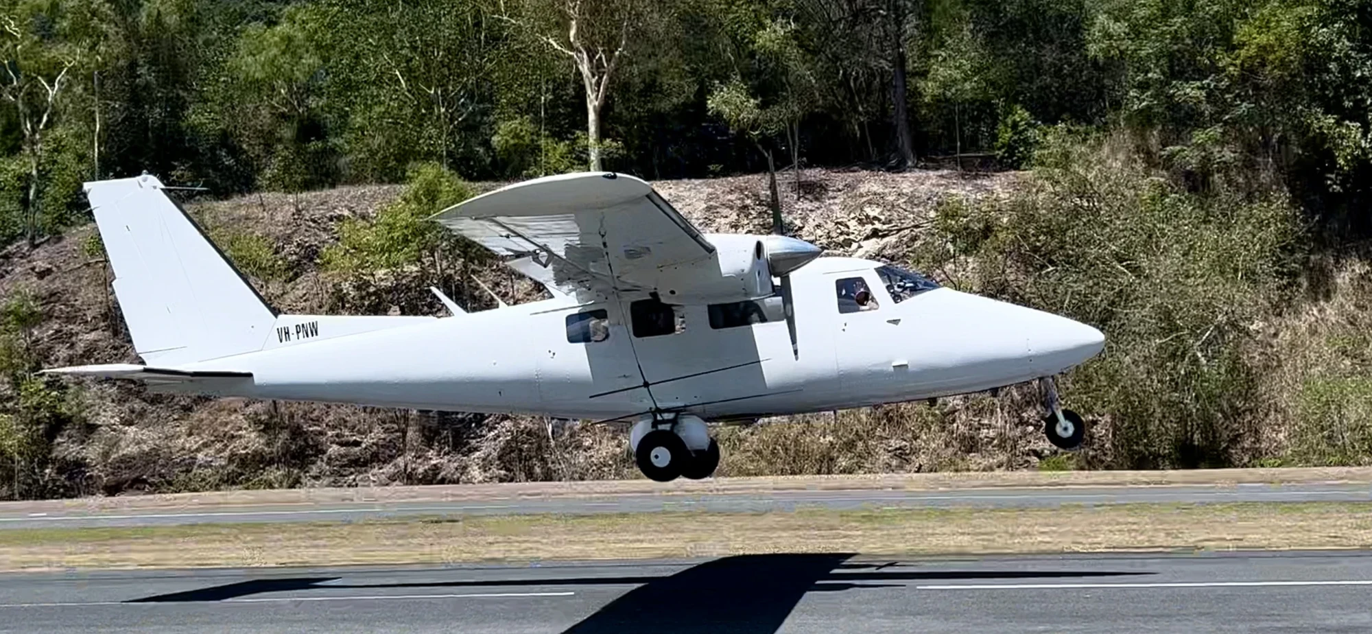
Our current AeroGlobe Pod V6 is the sixth generation of the imaging platform, developed for wildlife transect surveys and coastal mapping. The system integrates multiple cameras with GPS and inertial navigation data and is used on aircraft platforms including the Cessna 206, GA8 Airvan and Partenavia P68.
We design and build our airborne camera systems in-house and combine image capture with the georeferencing and data-processing workflows needed to deliver usable survey imagery.
 View image +
Flights follow the approved survey design, with image capture monitored during acquisition. Flight and capture logs record the survey sequence, and imagery is checked for usable exposure, focus and continuity.
The capture record is reconciled with the navigation and camera data. Image identifiers remain consistent through the photographs, sidecars, CSV records and GIS coverage files. Checks confirm that image files are paired with their georeferencing records and that delivered flight paths and footprints correspond to the survey imagery.
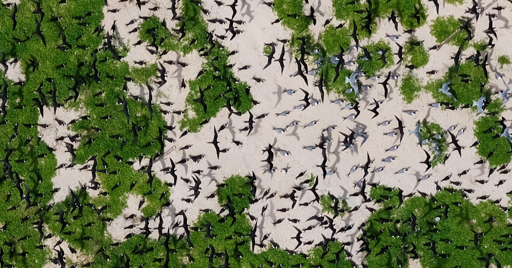
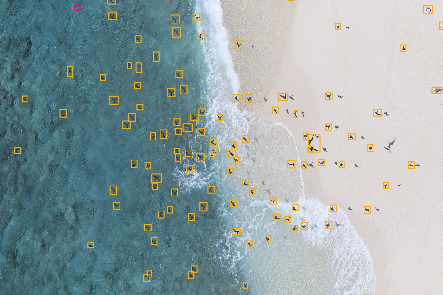
AeroGlobe’s software team develops the models, processing systems and review tools used to work with airborne wildlife imagery, from model training and deployment to production processing and quality assurance.
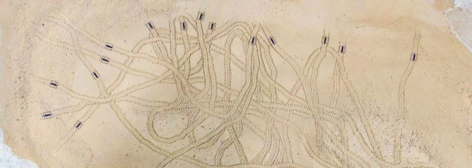
The work includes bird detection, turtle-track annotation and review, marine-debris workflows and image-analysis tools used by specialist reviewers.
 View image +
 View image +
A turtle-track digitisation process creates a library of track-section images grouped by islet or cay. Track images retain the context for classification, including unusual patterns, false crawls and associated observations.
 View image +
 View image +
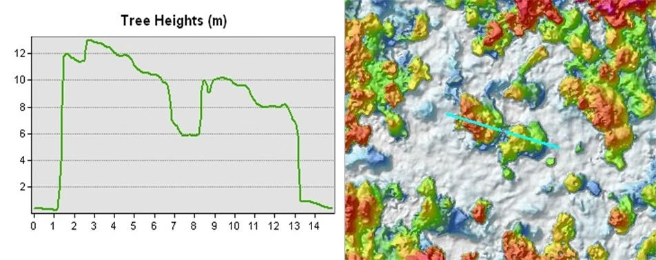
Orthomosaics, digital surface and terrain models, point clouds, vegetation layers and georeferenced map products are prepared for the needs of each survey.
Map products combine source imagery with observations and summary statistics. GeoPDF maps and GIS-ready files support analysis in existing software, while authorised users can explore project imagery through AeroGlobe Maps.
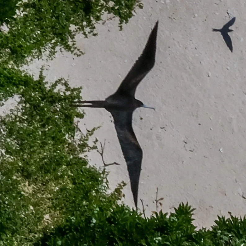
Maps loginBird imagery at 7, 28 and 40 mm ground sample distance (GSD).
 View image +
 View image +
 View image +
Ground sample distance is the size of one image pixel on the ground. The examples show how the detail available for species identification changes with image resolution.
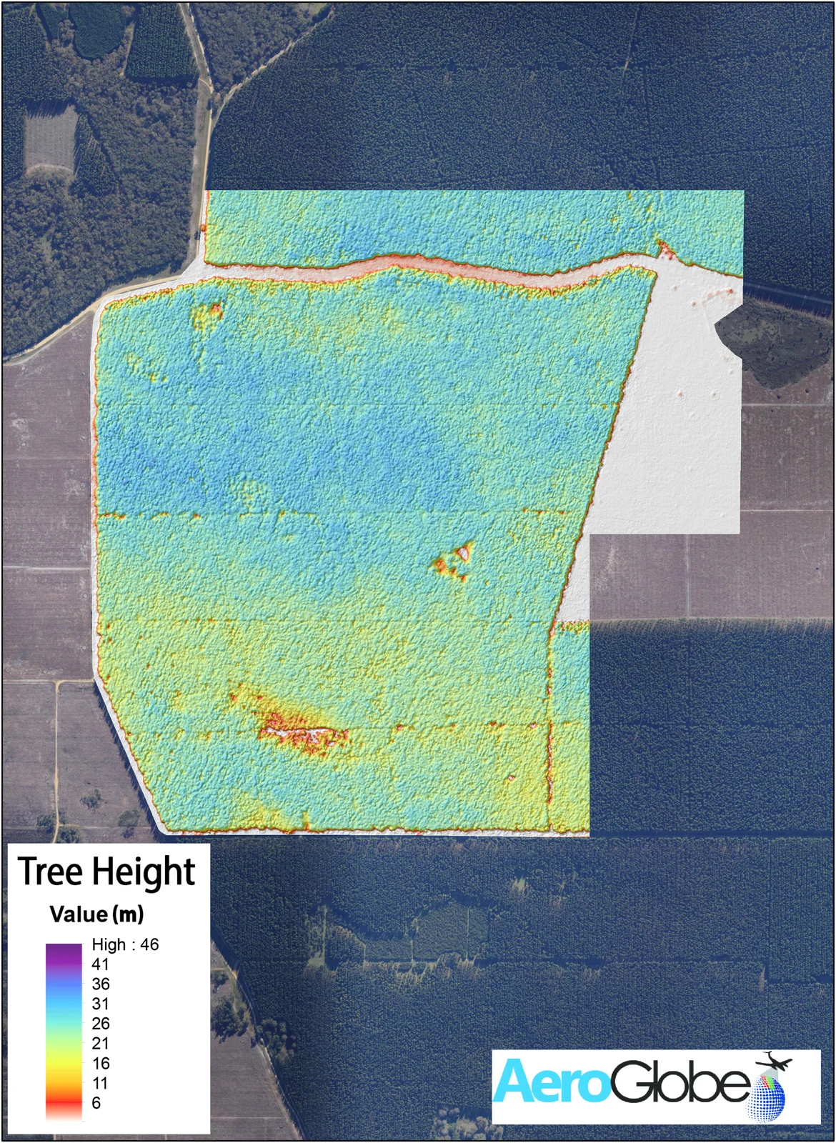
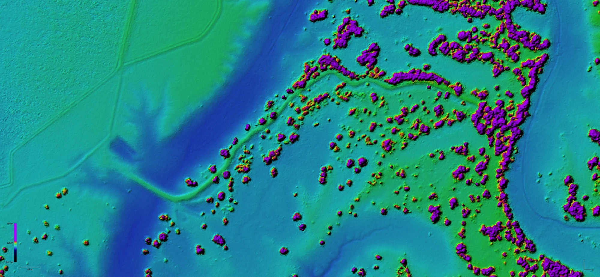
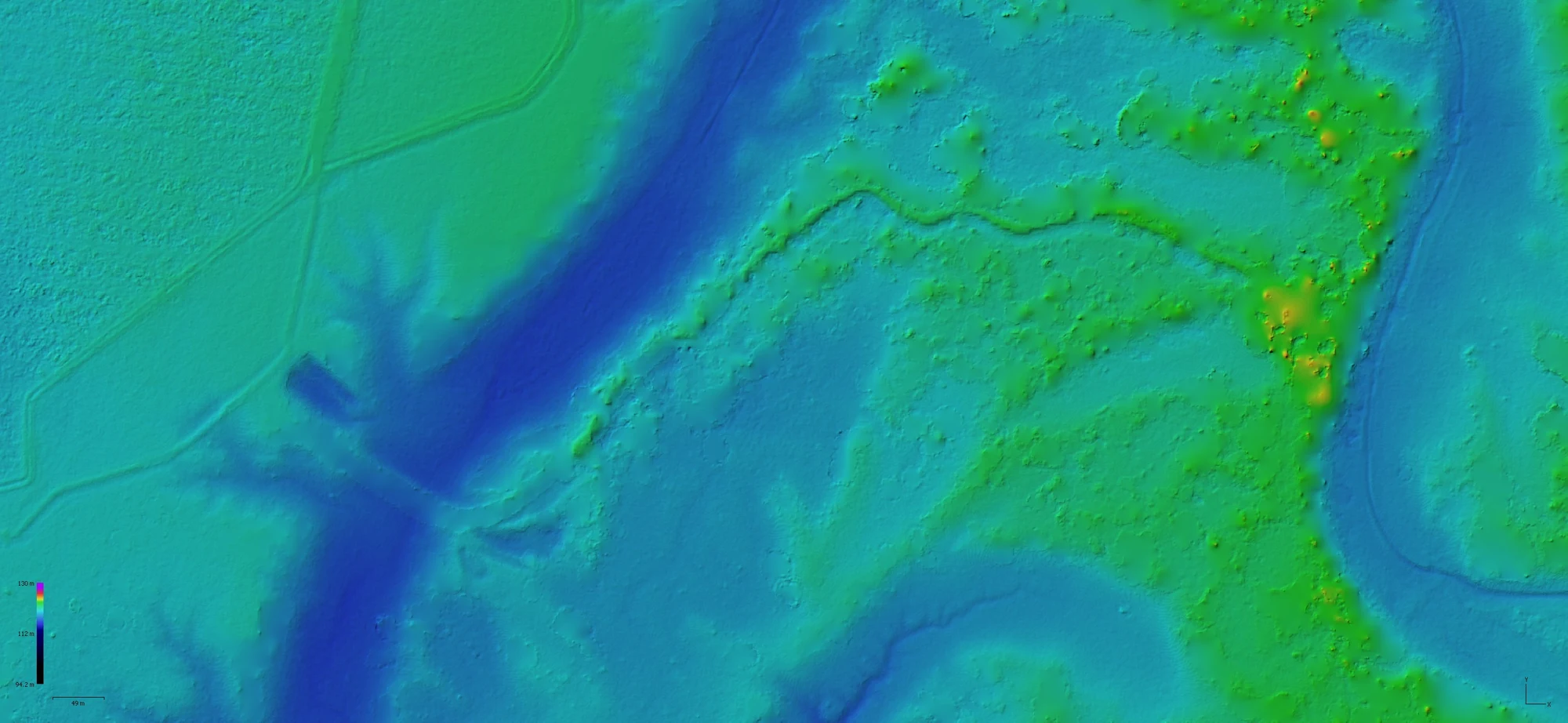
Surface models record the top of vegetation and structures; terrain models describe the ground. Their difference supports canopy-height analysis and the study of habitat structure.
 View image +
 View image +
 View image +
Animal-track annotation and research tools for our team and collaborators.
iTide team accessExplore the aerial image library, including landscapes, coastlines and disaster-response photography.
Browse AeroStockAviation support for our marine survey and remote field operations.
Visit Liddle’sAsk a question or request a quote for aerial survey, mapping or environmental analysis.